

Hurricane Sandy remains on course to hit Canada tonight with howling winds and drenching rain after blowing through the U.S. eastern seaboard. The Canadian Hurricane Centre expects the so-called Frankenstorm to punish parts of southern and eastern Ontario and western Quebec with potentially damaging winds up to 100 kilometres per hour. The Centre says rainfall amounts will vary from 20 millimetres in some areas to well over 50 millimetres in others. And it says that rain could change into snow over central Ontario. The latest forecast says the rain is not expected to reach the southwestern Maritimes until Tuesday morning, but could persist into Wednesday with total amounts exceeding 50 millimetres. Seven metre waves could lash the Great Lakes, especially southern Lake Huron, and large waves are also expected to pound Nova Scotia's south shore. It is a massive storm with tropical storm-force winds that extend some 800 kilometres from its centre. Environment Canada have issued a Wind Warning for our region. Severe winds of 60 km/h, gusting to 100 km/h are expected to begin this evening. They warn or sporadic power outages due to falling limbs and the possibility of toppling trees taking power lines down. Environment Canada are encouraging people to monitor weather conditions and listen for updated statements. A Special Weather Statement has also been issued. Click here to read full statement. Residents are being reminded to have an emergency preparedness kit in their home, in the case of a power outage. It is suggested you have food, water and a battery operated or wind-up flashlight in your kit.
 New Coaches Coming to Tavistock Braves
 Norfolk OPP Investigation Leads to Charge
 U14 Girls Oxford Attack Continue Season
 Province Increasing Speed Limit on 10 Sections of Highways
 EZT Strategic Plan Survey Closing Soon
 Realtors Care Food Drives Returns!
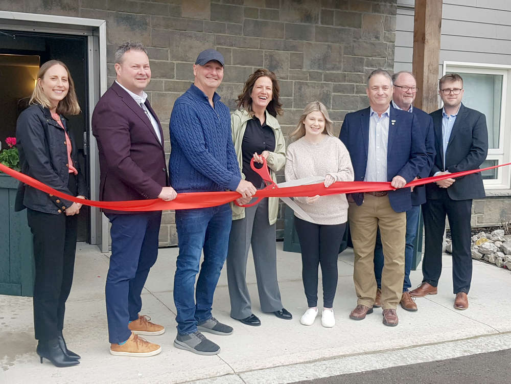 Plattsville Celebrates New Housing Complex
 Two Have Licence Suspensions in Oxford
 False 9-1-1 Calls Hit Norfolk County
 Woodstock Choralaires Hosting 70s Themed Show
 Thamesford Tim Hortons Accepting Smile Cookie Preorders
 Three Vehicle Crash Investigation in Brant
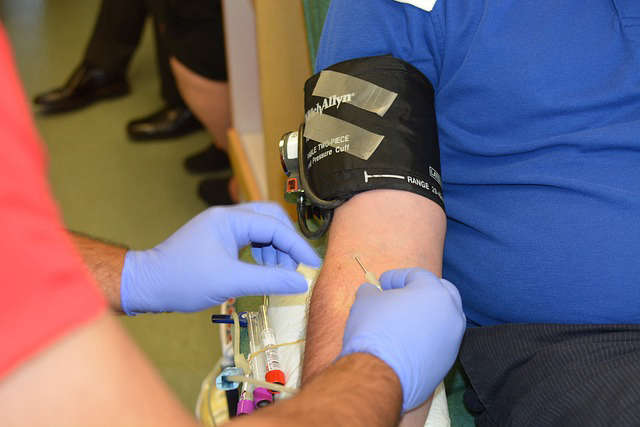 News Poll: Blood Donation
 WCI Red Players Present: Concert for the Cure 2024
 Oxford Resident Charged with Shoplifting
 Earth Day is Celebrated in Woodstock
 One Man Charged after Fraudulent Activity
 Norfolk OPP Catch Impaired Driver
 Woodstock Navy Club Welcomes Universal Washroom
 Oxford County Waste Survey Closing Soon