

According to Environment Canada, southern Ontario could see some significant snowfall Thursday. In a special weather statement, Environment Canada says early models are showing an Alberta Clipper combining with a Texas Low over southern Ontario Thursday afternoon into the evening which could bring heavy snow and accumulations to some areas. At this time, snowfall accumulations are tough to judge but early forecasts would indicate 10 to 15 cms possible for areas north of a line from Grand Bend to Hamilton to Kingston. South of these areas could expect any where from 5 to 10 cms of snow. Environment Canada says these are early estimates and they are tracking the two systems as they approach the region. They will issue further special weather statements as necessary. The timing of the storm could make travelling difficult Thursday evening and especially for the drive into work Friday morning. It was just last Friday that a band of heavy squalls dumped heavy amounts of snow in the Woodstock area leading to a 50 car pile-up on the 401.
 OPP Runs 'Stay Focused' Campaign
 Rec & Leisure Fair is Back
 Oxford Stewardship Award Nominees Announced
 United Way Thanks Community for Successful Campaign
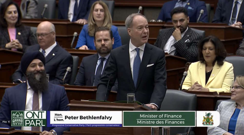 Budget Supports Home Buying, Small Business
 Impaired Driver Charged in Ingersoll
 Scratch Ticket Turns into $50,000 for Woodstonian
 Interview with the Warden - March 26th, 2026
 WCI Captains/Veterans Basketball Game Returns!
 Baxter Named PJHL Trainer of the Year
 Ontario to Table 2026 Budget Today
 UPDATE: Federal Offender Arrested in Kingston
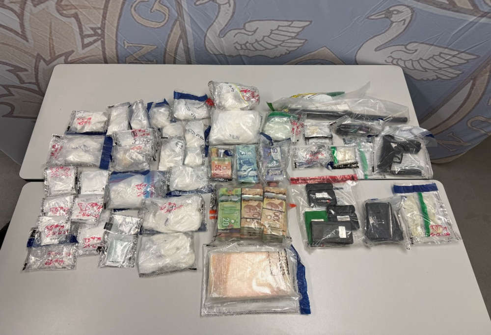 Project Sapphire Cuts Down Cocaine
 Stunt Driver Charged in SWOX
 Federal Minimum Wage to Increase
 Air Traffic Controller Shortage in Canada
 PJHL Playoff Recap - March 25th
 Introducing: the Woodstock Performing Arts Collective
 Illegal Drugs Seized in South-West Oxford
 Camp 85 Returns to Blandford-Blenheim