

The City of Woodstock will be investing in new aerial mapping next year. The current maps the city uses for planning are over 30-years-old. And with all the development over the last 5-years, City Engineer Harold DeHaan believes its high time the city invests in some new mapping. "We had council approve half the anticipated funds this year with the intent of getting the other half approved next year so that next year we can have the whole city flown aerially so we can get an aerial photography of the whole city". The total cost will be around $70,000. The Engineering Department uses the aerial maps frequently to study flooding complaints, and for planning reports. DeHaan says new technology in aerial mapping would allow the city to have maps that are accurate within 8cms.
 3rd Annual Running with the Bulls Shines
 Mischief in Tillsonburg is Under Investigation
 Upgrades Completed for Woodstock Disc Golf Course
 OPP Enforcement for Civic Holiday Weekend
 Woodstock Candidate Profile - Anthony Scalisi
 Drug Trafficking Investigation Leads to Charges
 EZT Candidate Profile - Don Chowan
 Oxford County Requesting Public Input
 Norwich Man Charged in Brant County
 SPWH Wants You to Know Drinking Risks
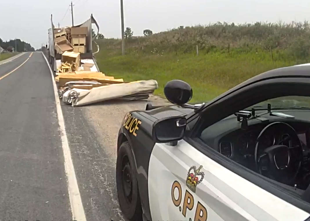 Charges Laid after Truck Hits Bridge
 Ingersoll Candidate Profile - Mike Tucker
 Motorcyclist Killed in Oxford Collision
 Tip Tuesday with the Oxford OPP - July 2026
 Oxford OPP Briefs - July 28th, 2026
 Cat Thrown from Vehicle in Norfolk County
 Environment Canada Issues Yellow Watch for Thunderstorms
 Oxford Mosquito Traps Tests Positive for West Nile
 Woodstock Candidate Profile - Sandeep Sidhu