


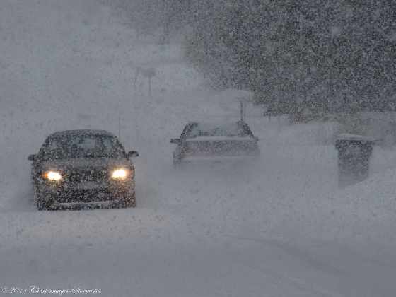
Meteorologist Steven Flisfeder says the snow should begin in Oxford County at around 4:00 p.m. We could get anywhere between 15 to 20 centimetres by the time it ends tomorrow morning.
OXFORD COUNTY - We have quite the snow storm heading our way.
Environment Canada has issued a winter storm warning for Oxford and Brant with the possibility of 15 to 20 centimeters of snow.
Warning Preparedness Meteorologist Steven Flisfeder says it should start at around 4:00 p.m. this evening, give or take a couple of hours. He adds the snow will become heavier as the evening progresses.
"We could get into some heavy snowfall rates which will reduce visibility quite significantly through the evening hours. That intensity will increase even further through the late evening, after the midnight period. So anybody who is out on the roads for Friday evening activities may want to reconsider their plans."
Environment Canada says we could see snowfall amounts of up to six centimeters per hour. We can also expect blowing snow, so the roads could become quite messy out there.
The snow should end tomorrow morning and Flisfeder says we're in for mild temperatures this weekend.
"Temperatures are going to be on the positive side. A few degrees above the zero-degree mark so you'll start to see a bit of (snow) melt. Something to keep in mind for anybody who has to do the morning shoveling tomorrow morning, the snow will start to melt and become quite dense so give your back a break if you have to be out shoveling in the morning."
He says the mild temperatures should continue into next week. Environment Canada is also tracking another small system that could pass through the area on Sunday or Monday.
 3rd Annual Running with the Bulls Shines
 Mischief in Tillsonburg is Under Investigation
 Upgrades Completed for Woodstock Disc Golf Course
 OPP Enforcement for Civic Holiday Weekend
 Woodstock Candidate Profile - Anthony Scalisi
 Drug Trafficking Investigation Leads to Charges
 EZT Candidate Profile - Don Chowan
 Oxford County Requesting Public Input
 Norwich Man Charged in Brant County
 SPWH Wants You to Know Drinking Risks
 Charges Laid after Truck Hits Bridge
 Ingersoll Candidate Profile - Mike Tucker
 Motorcyclist Killed in Oxford Collision
 Tip Tuesday with the Oxford OPP - July 2026
 Oxford OPP Briefs - July 28th, 2026
 Cat Thrown from Vehicle in Norfolk County
 Environment Canada Issues Yellow Watch for Thunderstorms
 Oxford Mosquito Traps Tests Positive for West Nile
 Woodstock Candidate Profile - Sandeep Sidhu


Comments
Add a comment