


Environment Canada says we could see significant rainfall mixed with snow through overnight.
A Texas low is making its way to Southern Ontario bringing with it plenty of rain and the possibility of wet-snow.
Environment Canada has issued a Special Weather Statement highlighting the possibility of significant rainfall with 15 to 25 mm likely to fall over much of Southern and Eastern Ontario. Areas near lakes Erie and Ontario could see higher amounts of 25 to 35 mm.
The rain should move into our region early to mid-afternoon Monday.
There's the chance for wet-snow through the overnight as the mercury drops to near zero temperatures. Areas to the north and through higher terrains, such as Dundalk or Haliburton Highlands could see accumulating snow of 5 to 10 cm. Local higher amounts are possible, especially over the Bancroft through Algonquin Park area, as well as the higher ground southwest of Collingwood including Flesherton, Singhampton and Shelburne.
More spring-like weather is on the way this week. By Thursday, temperatures are expected to climb to the mid to high teens, erasing any memory of tonight's possible snowfall.
 Tillsonburg Candidate Profile - Ron Gasparetto
 Interview with the Acting Mayor - June 15th, 2026
 Wienerfest Back in Burford Next Weekend
 Two Championships, One Weekend
 Five Children Killed in Mapleton Township Crash
 Woodstock Candidate Profile - Dave Bloxsidge
 Pride Family Day in Museum Square
 Oxford County Seeking Input for Future
 UPDATE: Oxford OPP Find Missing Teen
 Oxford OPP Investigating Stolen PRIDE Flags
 Woodstock Candidate Profile - Maureen Ralph
 2026 World Cup of Soccer is Underway
 Navy Vets Reveal First Round of Commits
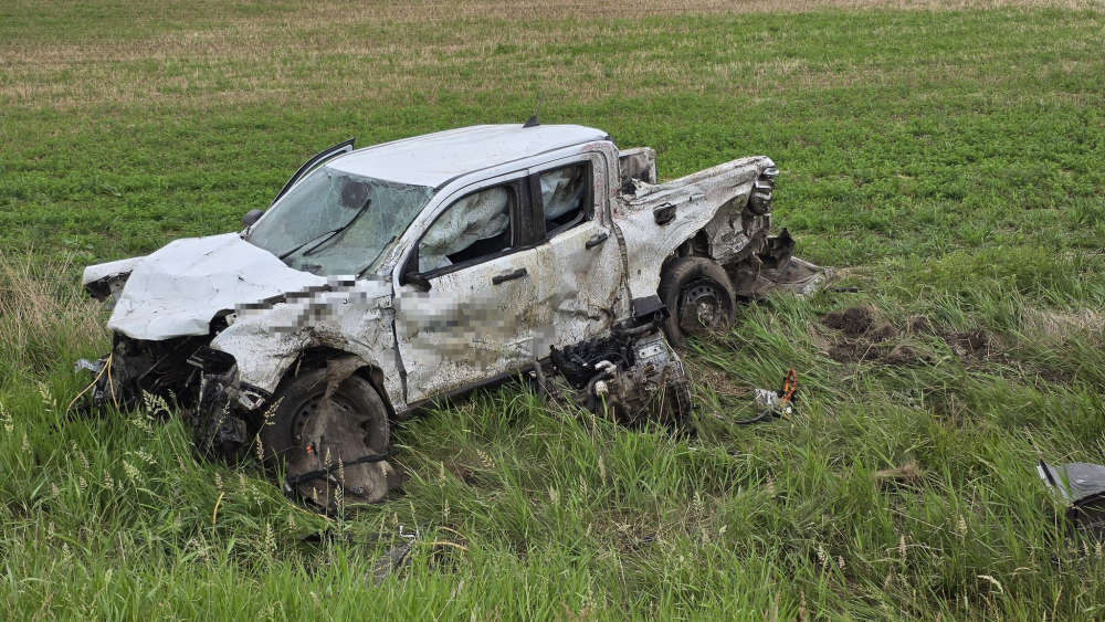 Pickup Truck vs. Transport Truck Collision in SWOX
 Interview with the Warden - June 11th, 2026
 Online Harms Legislation Tabled in Ottawa
 Royal Roads Family Fun Day Returns!
 Two Vehicles Collide Southwest of Scotland
 SWOX Firefighters Respond to Car Fire
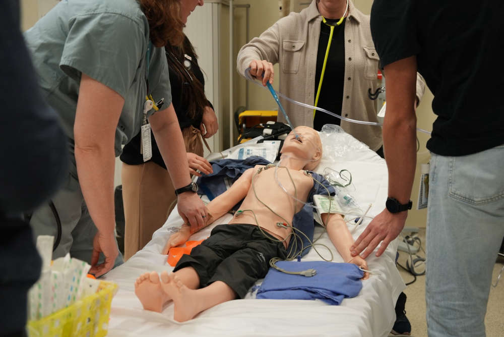 Hospitals to Receive Training for Paediatric Emergencies


Comments
Add a comment