


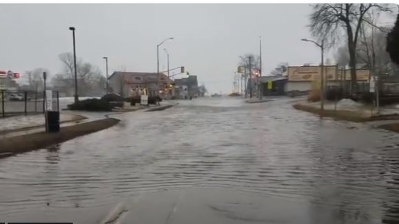
The Upper Thames River Conservation Authority is warning the public about the potential for significant flooding this weekend.
The Upper Thames River Conservation Authority is warning the public about the potential for significant flooding this weekend.
The UTRCA has issued a Flood Watch Bulletin. Marketing Specialist Steve Sauder says they do not issue bulletins often.
"The last flood watch we put out was in February 2018 and that is when there is a potential for flooding exists within specific water courses and municipalities. We are putting this one out in anticipation of the precipitation we are expecting tomorrow on Saturday."
Current forecasts call for 50 - 100 mm of rain over the two days, with most falling on Saturday. The ground is generally wet and/or frozen, and unable to absorb much rain. Fortunately, there is not a significant snow pack, with only about 10 mm of water equivalent in the snow. Sauder says the flooding will be more severe if we get 100 mm of rain.
"If we are into 50 mm, we still will have a dangerous situation around all waterways, all waterways will still be high and fast moving, we will have some over bank water, into some park areas and traditional flood plain areas such as golf courses and low lying areas. If we get up closer to the 100 mm range, that is where we will be looking at specific roads that will be closed, some problems with some trailer parks in lower lying areas and some of the parking lots in London as well."
With the lower forecast amount of rain, streams and rivers will be out of their banks in some areas and inundating low lying flood plains. If the higher rain forecast materializes, more significant flooding could occur.
The public is encouraged to exercise extreme caution around all local waterways. Banks adjacent to rivers and creeks are very slippery and, when combined with cold, fast-moving water, pose a serious hazard. Parents are encouraged to keep their children and pets away from all watercourses.
Peak flows in smaller streams and upstream river areas (i.e., Mitchell, Stratford, Tavistock, Ingersoll) should develop beginning early Sunday morning. The Thames and North Thames Rivers will peak in London during the day and into the early evening Sunday in London. River flows will remain higher than normal for several days into next week, increasing the safety risk around rivers and streams throughout the watershed.
Flood prone areas include:
City of Woodstock: Thames River at Highway 2; Cedar Creek at Southside Park
Thames Centre: Village of Putnam south of Highway 401; Reynolds Creek - Golden Pond Trailer Park
East Zorra-Tavistock: Braemar Trailer Park
Zorra: Ponderosa Trailer Park
City of London:
- Windermere Road and Adelaide Street
- Pumping station and London Hydro substation at west end of Killaly Road
- Parking lot adjacent to McNay Drain in North Thames floodplain behind apartment
- Parking lot behind Richmond apartments (across from Bernard Avenue)
- Gibbons Park (end of Victoria Street)
- Harris Park
- Pottersburg Creek at Oxford Street (Veterans Memorial Parkway)
- Waubuno Creek - Travelled Road, River Road
- Wellington Road and Front Street
- Coves trailer park
- Dingman Creek - various locations along Dingman Drive
Western University: Elgin Hall and Talbot parking lots, Tennis Centre
Middlesex Centre: Former Lady of Lourdes Catholic School site; River Road
Mitchell: Intersection of St George and Adelaide (south end of Parmalat)
Perth South: Prospect Hill Campground
West Perth: Motherwell area
City of Stratford: Dolan Drive; Avon Cemetery; Stratford Golf and Country Club
Town of St. Marys: Thomas Street between Park and Queen Streets; Parkview Drive; St. Marys Golf & Country Club
 Behind the Scenes: Bird Set Free
 Public Information Centre Announced for Homelessness Service Centre
 Conservation Authorities to Consolidate
 Woodstock Applying for Funds for New Rec Facility
 Woodstock Candidate Profile - Wes Mazur
 Woodstock Casino Celebrates 25 Years
 Woodstock to Honour Local High School Students
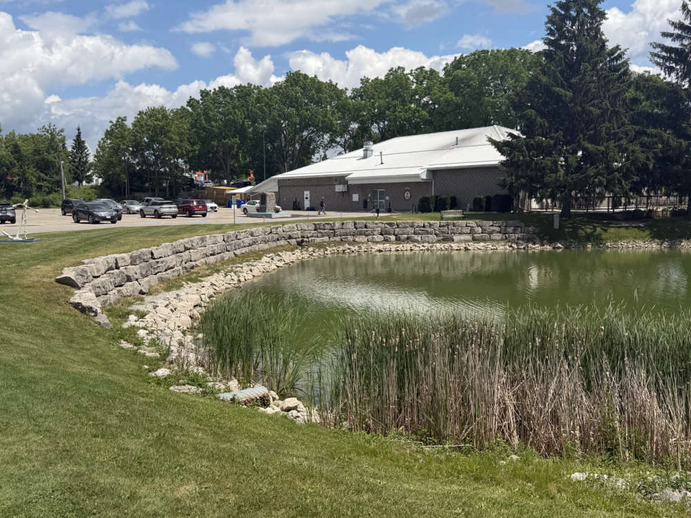 Low Water Levels in Woodstock Navy Club Pond
 Tillsonburg Candidate Profile - Katherine Englander
 A Busy May for Norwich Firefighters
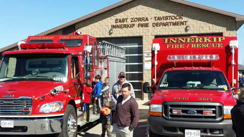 Innerkip Lions Weekend Fast Approaching
 Woodingford Lodge Launches Ostomy Support Group
 SWOX Candidate Profile - Peter Ypma
 Stormy Forecast Sparks Special Weather Statement
 Maple Leafs Hire New Coach
 Impaired Driver Charged on Rest Acres Road
 Plattsville to Celebrate 175th Anniversary
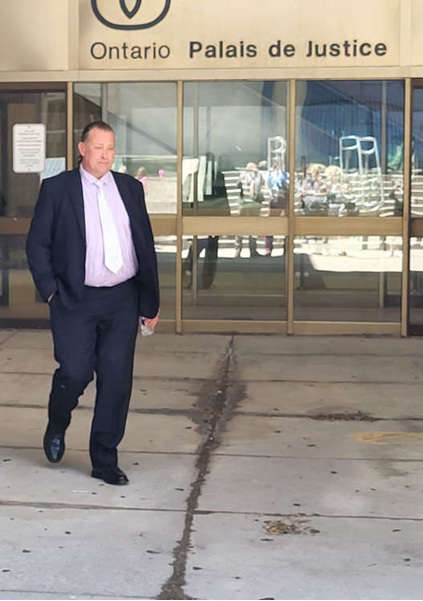 Trevor Birtch Mistrial Daily Recap
 Norfolk OPP Investigating Serious Collision
 Vandalism Reported at Gunn's Hill Artisan Cheese


Comments
Add a comment